MassRoam
Web app

Massachusetts · 14 Counties · 351 Towns

Explore Massachusetts's
historic places

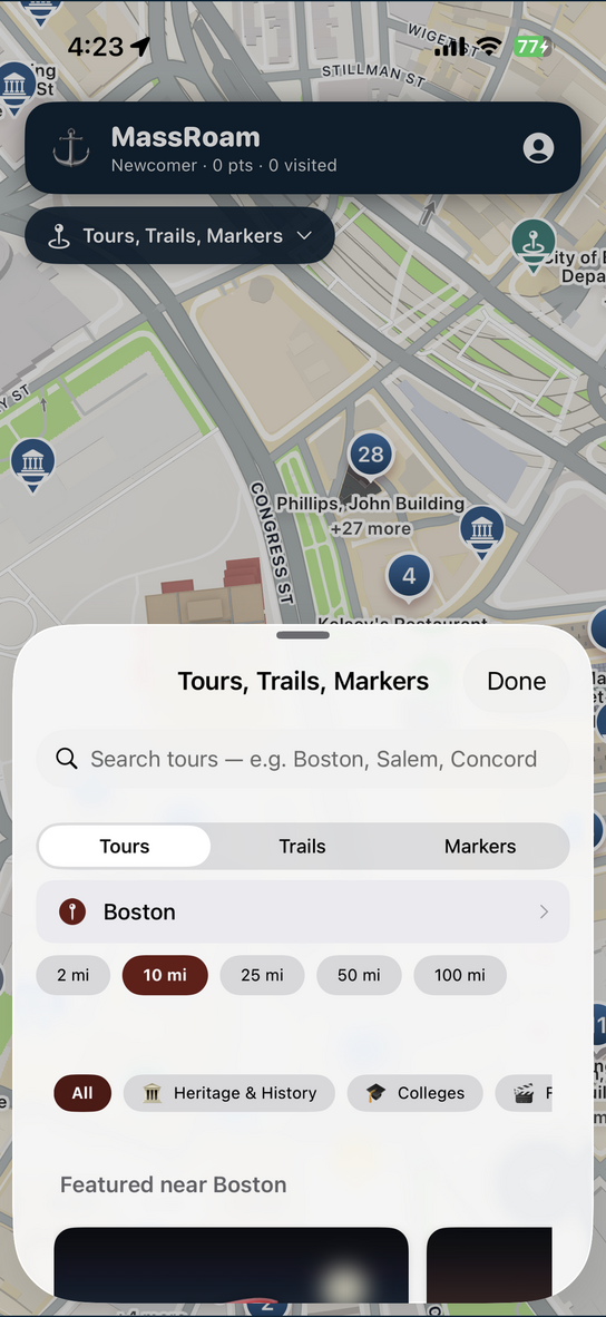
A gamified map of the Commonwealth's Revolutionary landmarks, old burying grounds, sea-captains' houses, courthouses, museums and lighthouses — with the real stories behind them. Visit them, collect them, learn them.

Free · you'll sign in with your Apple ID inside the app.

82,691 historic places 14 counties 351 cities & towns
What you'll discover

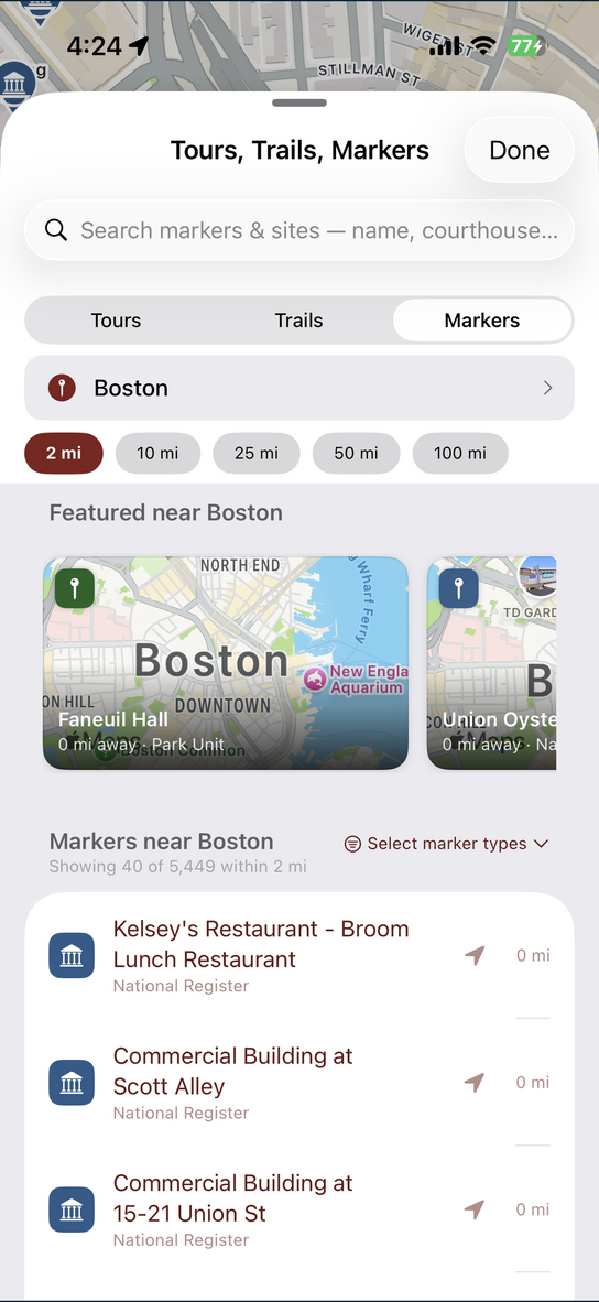
The whole Commonwealth's history, on one map

Sourced from the Massachusetts Historical Commission (MACRIS) and public archives, checked, and written up in plain language.

🏛️
77,209
Historic sites & landmarks
🪧
4,651
Markers & monuments
⚰️
509
Old burying grounds
🎓
200
Colleges
🖼️
76
Museums
⚖️
46
Courthouses

Roughly 72,000 are listed on the National Register of Historic Places — the second-largest total of any state.

One state, many worlds

From Boston Common to the Gay Head cliffs

Massachusetts packs Revolutionary cities, witch-trial villages, whaling islands, mill towns and Gilded-Age hills into one small state. Roam any of them.

🏛️

Boston & the Freedom Trail

The golden State House dome, Beacon Hill's gas lamps, Faneuil Hall and the red-brick line where the Revolution was lit.

Suffolk County
🔮

Salem & the North Shore

The 1692 witch-trial memorials and Witch House, Gloucester's fishing wharves, and the granite headlands of Cape Ann.

Essex County
🐚

Cape Cod

Dune-backed lighthouses, weathered saltbox villages, cranberry bogs, and Provincetown's harbor at the fist of the Cape.

Barnstable County
🏖️

Martha's Vineyard

The gingerbread cottages of Oak Bluffs, the fishing docks of Menemsha, and the striped clay cliffs of Aquinnah.

Dukes County
🐋

Nantucket

The grey-shingled whaling capital of the world — cobblestone Main Street, captains' mansions, and Sankaty Head Light.

Nantucket County
🍂

The Berkshires

Gilded-Age summer "cottages," Tanglewood, Stockbridge, and the literary hills of Herman Melville and Edith Wharton.

Berkshire County

Plymouth & the South Shore

Where the Mayflower landed — Plymouth Rock, Pilgrim Hall, and the salt marshes and shipyards of the coast south of Boston.

Plymouth County
🎓

Pioneer Valley

College-town spires along the Connecticut River, Emily Dickinson's Amherst, and Springfield's armory and inventions.

Hampshire & Hampden

Follow a thread

Curated trails through the past

Themed collections that connect the dots across the Commonwealth.

Featured route

The Revolution

Boston to Lexington and Concord — the Freedom Trail, the Old North Church, Bunker Hill, and the Minute Man road where the war began in April 1775.

Featured route

Salem, 1692

The witch-trial sites, the memorial, the Witch House and the old burying points of Essex County — the year fear swept the Commonwealth.

Featured route

The Whaling Coast

New Bedford and Nantucket wharves, sea-captains' mansions, and the lighthouses that ring Cape Cod and the Islands.

🧱
Free self-guided walk

The Freedom Trail

Follow the red-brick line 2.5 miles through downtown Boston — narrated stops that trigger on your phone as you arrive, from Boston Common and the Old State House to Paul Revere's House, the Old North Church, and the Bunker Hill Monument in Charlestown.

16 landmark stops · ~2.5 miles · ~2 hours · the walk that started a nation
🔒
Private by design

Sign in with Apple — and only you see your map

You open the map by signing in with your Apple ID, right inside the web app. The historic-site data is never public: it's served only to signed-in visitors through an authenticated connection, so there's nothing to scrape and no account to create. Your visits, points and progress sync privately to your Apple account across iPhone, iPad and the web.

Start roaming Massachusetts

Free to explore. Your visits, points and progress sync to your Apple account.

Open the web app →